An Adventurers Guide To The Bibbulmun Track
Before we start, let me just say one thing: to really explain what the Bibbulmun Track (AKA the Bibb) is like in detail, I would need to write a novel. But for time-saving reasons, I’ve tried to distil that novel into less than 1200 words. You’re welcome.
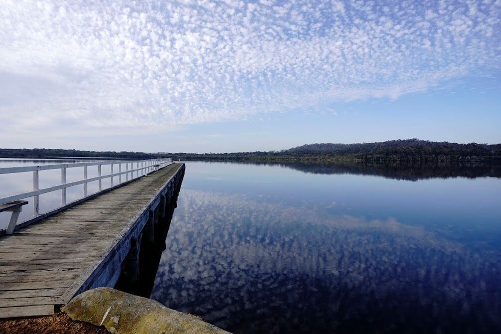
The Bibb Track is located in the south west of Western Australia, stretching just over 1000 km from Perth to Albany. It takes a very winding route (to drive straight from Perth to Albany is about 400 km) to showcase some of the incredible diversity of the south west. The first three-quarters of the track are inland, and the last 250 km are along the coast (my absolute favourite part). The Bibb is marked along the way by track markers which depict a waugal - a snake-like dreamtime creature from Noongar culture. The frequency of the waugals changes throughout the track, from 50m apart in tricky sections to 500m or more in other, more straightforward sections. They are not snake warning signs, and indeed are sometimes the most comforting sight you have seen all day when you’re not sure whether you’re on the right track or not.
Your first point of call when considering doing any or all of the Bibb should be the Bibbulmun Track Foundation website. These guys live and breathe the track, and there is a host of info on the site. If you sign up to be a member of the foundation ($40 for a year) you get free track planning advice - which I found really helpful. You can do it in person if you live in Perth, or via email if you don’t. Someone who has walked the track a lot can give you advice on things like places to stay, your proposed itinerary, questions about facilities in each track town, etc. The foundation also runs workshops and talks to help your prepare for your hike.
The most popular times of year to do the Bibb as a thru hike (called an ‘end to end’) are spring and autumn. It can get very wet, cold and flooded in winter, and very exposed, hot and dry in summer - with very high bushfire risks in some areas. I did my end to end in September and October, which is one of, if not the most, popular time - the weather is (supposed to be) better and the wildflowers are out. Even then, it wasn’t unusual to walk all day without seeing another person until I reached the next shelter - it is not in any way a crowded track.
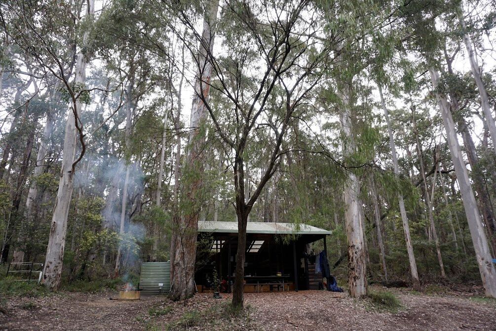
The Bibb has amazingly good facilities, especially considering it’s free. Lots of the track is maintained by volunteers, who do an amazing job at keeping the track clear. There are 49 campsites along the way, equipped with three-sided shelters, a long-drop toilet, a picnic table and a rainwater tank. In the northern section, there are also fire pits (no open flames allowed in the south). The shelters have sleeping platforms, in different configurations depending on when they were built. In the north, most of them are rectangular and have an upper and lower platform, in the south, it’s a one level platform that’s shaped like an L. You also pass through nine ‘track towns’ which range from basically one tiny general store with a few chalets, to a fully-equipped rural town with things like major supermarkets, pharmacies, a post office etc. Every track town has a facility that you can post resupply boxes to, which is awesome. I sent myself boxes of food to smaller towns, and resupplied at the shop in the larger towns. This system worked well for me (except for the one time that I accidentally posted myself a resupply box with two days of food instead of five days of food...d’oh! Luckily the general store in the town had my back).
The shelters are set along the track so that it’s a walkable distance between each one. In the north the distances can be so short (8 - 12 km) that it’s quite easy to do a ‘double’ and skip one shelter, in the south many of the distances are a bit longer (up to 25 km). The track has also been created to encourage you to stay in the towns, to skip a town would be like doing a double between shelters. Some towns are well set up to receive walkers, with camping stores and discounts on accommodation, some towns...are more difficult. When I went through, no less than two towns didn’t have any gas in stock for me to resupply - luckily my track buddies and family helped me out. There were also two towns where there wasn’t anywhere in the whole town that was open for dinner - you had to get a lift to the next town over or cook at your accommodation.
I found 20 - 25 km a reasonably easy distance to walk on most days. I did the whole hike in 50 days - which for a 1000 km track, averages 20 km a day. After the first week, less than 20 km actually felt a bit unfinished, like I hadn’t quite walked enough yet. The longest day I did was 43 km, which was a double. It was a full-on day (I walked with a track-buddy that day - we got up at 4:30 am, left at 5:30 am in the dark and the rain, to beat some torrential rain, hail and 70 km per hour winds that were forecast. This was fine, except it meant we got to the first hut at 10am - and we thought, well, either we keep going, or we sit around here all day..so we kept going. Through the storm!) Having said that, I’ve heard that when people walk the PCT and other long distance hikes, they average 40 km a day, so 20 km a day average seems quite chill!
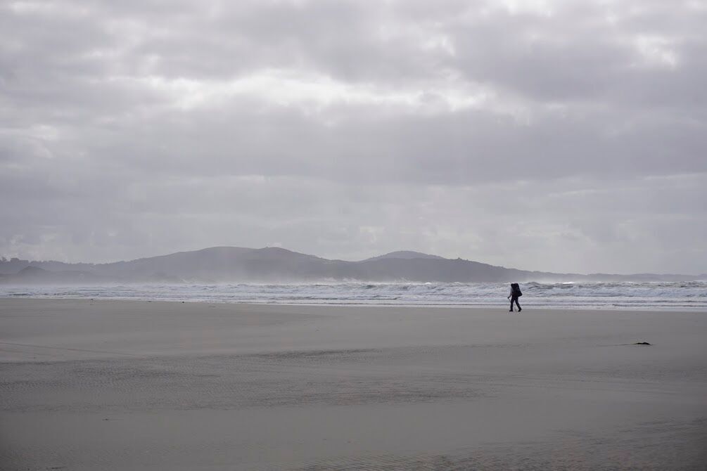
There are a couple of days on the Bibb where the distance belies the difficulty of the terrain though. Just north of Pemberton, there are several days walking along the banks of the Donnelly River - the area is known as the ‘Donnelly Roller Coaster’ as it is constantly going up and down - up and down is harder than walking on the flat. Walking through the ‘Pingerup Plains’ north of Walpole consists of (in winter/spring) walking through ankle-knee deep water (sometimes up to hip high when crossing a stream) for 100’s of meters at a time - when it’s deep mud underneath the water, this can really ramp up the difficulty factor. Walking 20 km in a day is much easier than wading 20 km! Just south of Peaceful Bay, there is a section where you need to canoe across an inlet - it’s only a couple of hundred metres (and is really fun), but if there’s a strong wind and you need to do a couple of trips (to even up canoe numbers on each side) it can add a lot of effort to your day. There are two long beach walks in the southern section, Parry/Mazzoletti beach and Muttonbird beach - each around 7 km. If the tide is low and the sand is firm and it’s not windy, these are a joy to walk along. If you hit it at a bad time though, and the sand is soft and the angle of the beach is steep and there’s a strong head wind - again, the distance of the day’s walk belies the difficulty. These are just a few examples of times when, although the distance of the day’s walk might look easy in terms of the number of kilometres, it is actually quite challenging. This is why it’s worth running your planned itinerary past someone from the Foundation.
I hope if you’ve been thinking about doing some or all of the Bibb track, this has given you some food for thought. I absolutely recommend it as an awesome challenge, a way to really experience the diverse flora and fauna we have here in Australia, and a way to get real with yourself.
Comments
Categories
Upcoming Events
-

Women's Mount Kosciuszko Hiking Trip // 19th - 22nd November 2025
The highlight of this trip is the rewarding ascent to the top of Australia - Mount Kosciuszko. Exper... -

Women's Mount Kosciuszko Hiking Trip // 14th - 17th November 2025
The highlight of this trip is the rewarding ascent to the top of Australia - Mount Kosciuszko. Exper... -

Women's Hinchinbrook Island Kayaking Trip // 2nd - 9th August 2025
Nestled off the tropical coast of North Queensland, between Ingham and Mission Beach, are 15 contine... -

Women's Mount Kosciuszko Hiking Trip //14th - 17th March 2025
The highlight of this trip is the rewarding ascent to the top of Australia - Mount Kosciuszko. Exper... -

Women's Easy Rapids Kayaking Sunday 8th December
Join a fabulous day kayaking in Kangaroo Valley with a little 'twist' on running water.


